
From a sharing page to a planning tool
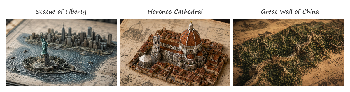
One HTML file, 33 landmarks
Last September I made Global Journey — a video where world landmarks rise from blueprint paper as 3D relief miniatures. After publishing the video, I shared the prompts on a single HTML page hosted on Gemini. People could browse prompts and copy them, but that was it.
Over time I kept thinking: this could be more useful. What if you could search landmarks on a map, switch between visual styles, plan a route with automatic camera transitions, and export the whole script?
I can't write code, so "rebuild it" meant something specific: I wrote down everything the tool should do, handed it to AI, and spent my time on the parts I can judge — what it looks like, how it feels to use, and whether the prompts it produces actually generate good images.
一個 HTML 檔,33 個地標
去年九月我做了環球旅程:城市浮雕之旅——一支世界地標從藍圖紙上浮現的 3D 浮雕動畫影片。影片發佈後,我把所有 prompt 放在一個 Gemini 分享頁面上,讓大家可以瀏覽和複製。
但用了一陣子後,我一直覺得:這可以更好用。如果能在地圖上搜尋地標、切換視覺風格、規劃路線並自動生成轉場 prompt、最後一鍵匯出整份腳本呢?
我不會寫程式,所以「重寫」的意思是:我把工具該做到的每件事寫清楚交給 AI,然後把時間花在我判斷得了的部分——長什麼樣子、用起來順不順、產出的 prompt 生圖好不好看。
What it does now
97 landmarks, six continents
The original video had 33 landmarks. I expanded to 97 — covering places the first version missed: Petra, Machu Picchu, the Great Barrier Reef, Table Mountain, the Galápagos Islands, and dozens more.
Every landmark has:
- An English MidJourney prompt with
--ar 16:9 --style raw - A Chinese translation
- A cinematic animation prompt for video tools (Seedance / Kling)
- Its location on the map
- A short list of visual features that the style templates build on
97 個地標,六大洲
原版影片有 33 個地標。我擴展到 97 個——補上了第一版沒有的地方:佩特拉、馬丘比丘、大堡礁、桌山、加拉巴哥群島等等。
每個地標都有:英文 MidJourney prompt、中文翻譯、影片動畫 prompt、地圖上的位置、以及風格模板用的特徵描述。
Interactive map
A vintage map to match the blueprint world
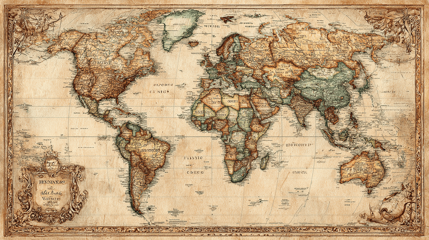
The map is built on OpenStreetMap — free, no account needed. Out of the box it looks like a modern navigation app, which clashed with the aged-blueprint world of this project. So I had AI wash the whole map in a subtle sepia tone — slightly faded, slightly warm, like a chart that's been rolled up in a drawer for years.
Markers are color-coded by continent. Where landmarks crowd together, they merge into numbered circles — click to zoom in and see them individually. Click any marker to see its name, location, and a "View Prompt" button that scrolls down to the card.
The map also responds to the continent filter pills. Pick "Asia" and only Asian landmarks remain on the map.
一張配得上藍圖世界的復古地圖
地圖用的是 OpenStreetMap——免費、不需要帳號。它原本長得像現代導航 app,跟這個專案的舊藍圖世界觀很衝突,所以我請 AI 幫整張地圖罩上一層淡淡的復古色調——微微褪色、微微偏暖,像在抽屜裡捲了很多年的舊海圖。
標記依大洲分色。地標太密集的地方會自動合併成帶數字的圓圈——點一下就放大看到個別地標。點任何標記都能看到地標名稱、位置、以及一個「View Prompt」按鈕直接跳到下方卡片。
地圖也會跟著大洲篩選列連動。選「亞洲」,地圖上就只剩亞洲的地標。
Style templates
Five ways to see the same landmark
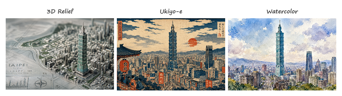
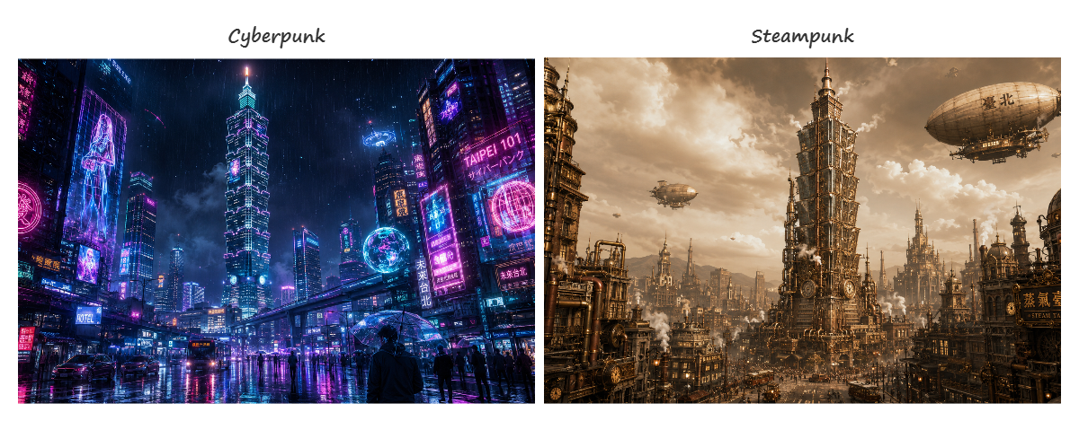
The default style is the original 3D relief on aged blueprint. But I added four more: Watercolor, Cyberpunk, Ukiyo-e, and Steampunk.
When you pick a style, every card updates instantly. The composed prompt appears highlighted at the top of each card, with the original prompt dimmed below for reference. Every style follows the same recipe: the landmark's name and visual features stay, while the style's art direction and color words swap in around them.
So "Taipei 101" in Ukiyo-e becomes something like: Taipei, Taiwan: Japanese ukiyo-e woodblock print of a skyscraper with stacked-pagoda design, deep indigo, vermillion, and gold leaf --ar 16:9 --style raw
同一個地標的五種風格
預設風格是原始的藍圖上 3D 浮雕。但我另外加了四種:水彩、賽博龐克、浮世繪、蒸汽龐克。
選一個風格,所有卡片立刻更新。組合後的 prompt 高亮顯示在卡片上方,原始 prompt 淡化顯示在下方做對照。每種風格都是同一套配方:地標名稱和特徵不動,風格的美術方向和色彩詞彙換上去。
Route planner
Plan a cinematic journey
This is the feature I'm most excited about. You add landmarks to a route, drag to reorder them, and the tool auto-generates Chinese transition prompts between each pair:
穿梭動畫,鏡頭從台北101飛越海面,穿過城市與森林,來到一片空白地面上,建築物如雨後春筍一般從空白地面拔地而起
Hit "Export .txt" and you get a complete production script: each landmark's full prompt, followed by the transition to the next stop, ready to paste into your video workflow.
Your route is remembered by your own browser — close the tab, come back tomorrow, it's still there.
規劃一條電影級路線
這是我最興奮的功能。把地標加入路線、拖拉調整順序,工具就自動在每對地標之間生成中文轉場 prompt。
按「Export .txt」就會匯出一份完整的製作腳本:每個地標的完整 prompt,加上到下一站的轉場動畫 prompt,可以直接貼到影片製作流程中使用。
路線會由你自己的瀏覽器記住——關掉分頁,明天回來還在。
Custom generator (BYOK)
Bring your own Gemini key
All 97 landmarks can be browsed without any key. But if you want to generate a prompt for a landmark that's not in the list — say, your hometown temple or a building you saw on a trip — you can enter your own Gemini API key (a personal key you request from Google that lets the tool use Gemini on your behalf).
Type a place name, hit Generate, and it returns a prompt in the same 3D relief style, with Chinese translation and animation prompt included.
The key stays in your own browser and talks directly to Google. Nothing passes through me — I have no server, so I couldn't see your key even if I wanted to.
自帶 Gemini Key 自訂生成
97 個地標不需要任何 key 就能瀏覽。但如果你想生成清單以外的地標——比如你家鄉的廟或旅行中看到的建築——可以輸入自己的 Gemini API key(就是向 Google 申請的一把個人鑰匙,讓工具能代你使用 Gemini)。
輸入地名、按 Generate,就會回傳同風格的 prompt,附帶中文翻譯和動畫 prompt。
你的 key 只留在你自己的瀏覽器裡,直接跟 Google 對話。中間不經過我——我連伺服器都沒有,想看也看不到。
How it's built (the honest version)
My three requirements
The code is entirely AI-written; I can't read a line of it. What I gave the AI instead of technical opinions was three hard requirements: it has to load fast, it must never ask anyone to create an account, and everything a user enters — routes, keys — has to stay in their own browser instead of being sent anywhere.
The AI chose a deliberately lightweight way to build it. My acceptance test was simple: open the page on my phone, count the seconds, try every feature, close the browser, reopen, check nothing was lost.
怎麼做的(誠實版)
程式碼全部是 AI 寫的,我一行也看不懂。我給 AI 的不是技術意見,而是三條硬需求:要開得快、絕不要求任何人註冊帳號、使用者輸入的東西(路線、金鑰)全部留在他自己的瀏覽器裡,不准傳到任何地方。
AI 選了刻意輕量的做法。我的驗收方式很簡單:用手機打開頁面、數秒數、每個功能點一遍、關掉瀏覽器再打開、確認東西都還在。
Try it
Global Journey Prompt Planner — browse, search, plan, export. No account needed.
See the video that started it all: Global Journey: A City Relief Adventure
Read how the video was made: Behind the Scenes — 從一張截圖到六大洲一鏡到底
來玩
Global Journey Prompt Planner — 瀏覽、搜尋、規劃、匯出。不需要帳號。
看看一切的起點:環球旅程:城市浮雕之旅
影片幕後:從一張截圖到六大洲一鏡到底